Exploration surveys without permanent benchmarks and with fewer repeat measurements
Gravity mapping
Less precision requirements than monitoring, because geological uncertainties are larger. Usually the signal of interest is larger as well.
Less precision requirements than monitoring, because geological uncertainties are larger. Usually the signal of interest is larger as well.
Detailed surveys for near-surface exploration for e.g. minerals, thickness of post-glacial sediments or archeological targets. Stations are usually <200 m apart and the gravimeter and navigation instruments are best transported by foot in a single-person operation. With Scintrex CG-6, accuracy of a few µGal can be achieved at a rate of 4-6 stations per hour.

Gravity mapping for exploration has less precision requirements than monitoring, because geological uncertainties are larger. Usually the signal of interest is larger as well.
Shipborne gravity measurements may have an accuracy of 0.5 – 1 mGal, dependent on sea-state and other factors.
Gravimeter systems towed above the seafloor or installed in an AUV may obtain 0.1 – 0.4 mGal precision (e.g. Zumberge et al., 1997, Ishihara et al., 2018).
Three advantages obtained when measuring at the seafloor are 1) a stable platform for the sensor gives higher precision, 2) no correction for sensor movements are required, and 3) the sensor is closer to the masses of interest, causing that gravity signal to be stronger.
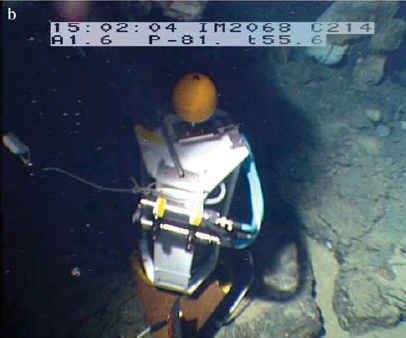
Scintrex’ INO sea-floor gravity meter with a CG-5 sensor in an 80 kg sphere inside a 135 kg cage is rated at 600 m water depth. Quad Geometrics’ ROVDOG system with a CG-6 sensor is only a fraction of the weight and volume and can be enclosed in a pressure case rated at 2000 m water depth or more.
Because of the relaxed accuracy requirements in mapping compared to time-lapse surveys, only few control repeats will be needed to control the drift sufficiently, as for land exploration. Seafloor benchmarks will generally not be needed, but could improve precision at repeat stations. If no benchmarks are used, the instrument package (ROVDOG) could be lowered to the seafloor by the ship’s crane. A large base plate would help stabilise the tilt during the gravity measurements. In surveys with a station spacing < 5-10 times the water depth, it may be faster to keep the instrument in the water during transits.
Seafloor gravity mapping may be used for mineral exploration, geotechnical near-surface investigations, subsea volcanoes, tectonic studies and more academic and commercial challenges.
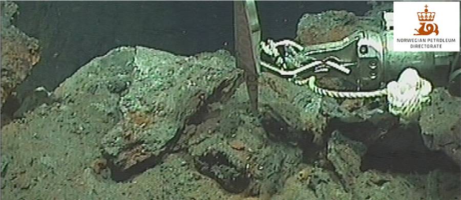
ROVDOG on a benchmark at the lucky strike volcano, mid-Atlantic ridge. From Ballu (2009).