Photo by Inger-Lise Solberg/Geological Survey of Norway.
Gravity Monitoring for Geohazard Prediction
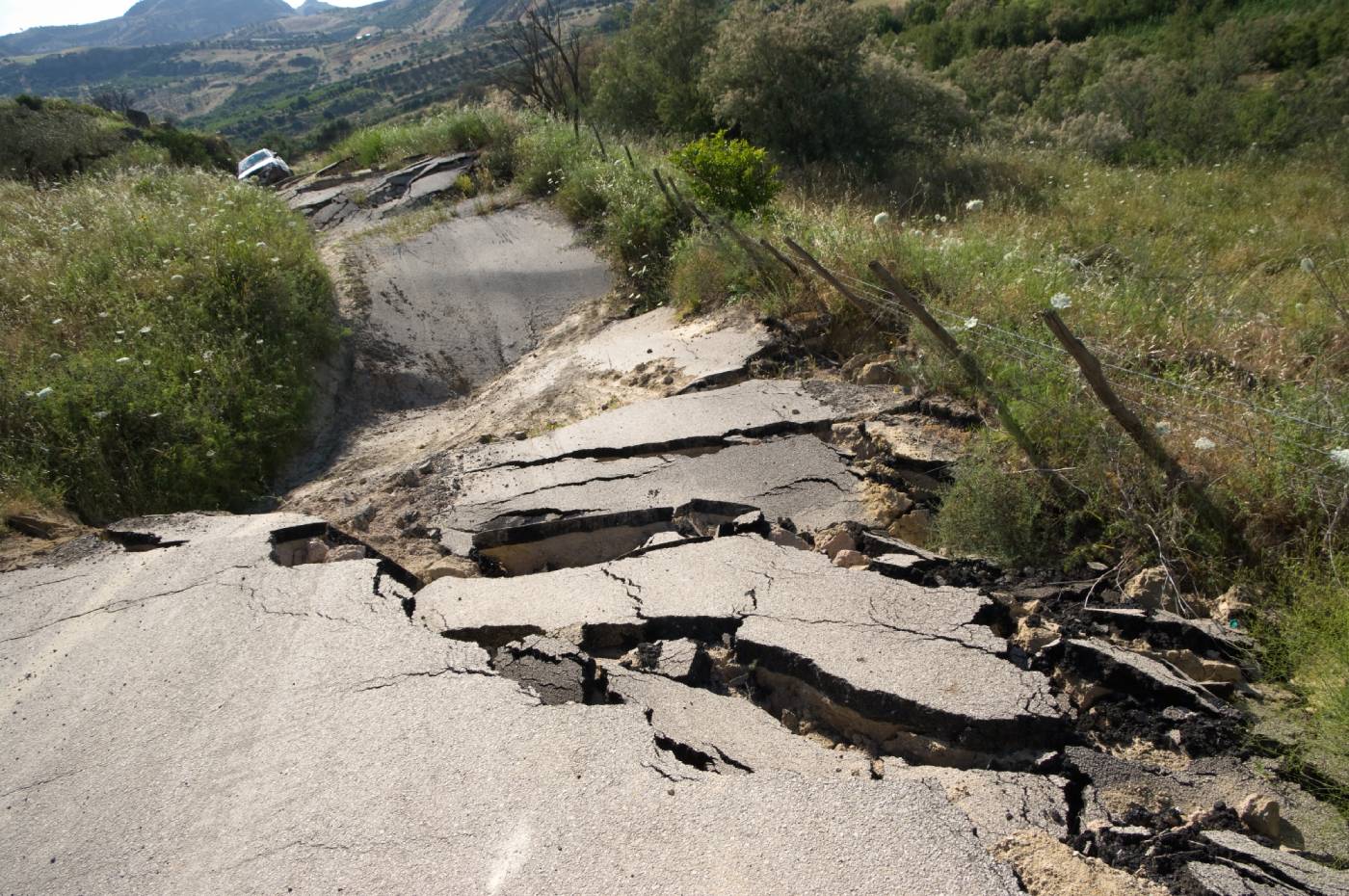
Landslides, rockslides, quick clay slides
When water or moisture changes, stability may be reduced. Gravity may give early warnings for these changes. Heinze et al. (2019) measured gravity repeatedly at Mount Zugspitze in Germany and correlated changes with water in the cracks. This again could be related to the hydrostatic pressure build-up and potential for rock failures.
Mouyen et al., (2020) quantified sediment mass redistribution in a wide meander of a river and a slow landslide in Taiwan from joint time-lapse gravimetry and photogrammetry surveys. They surveyed 10 stations with CG-5 (relative) and A-10 (absolute) gravimeters in november of 2015, 2016 and 2017. At the same times they generated high-resolution digital surface models from a drone to quantify the sediment volume. They could estimate a slow landslide causing a sediment mass loss of 3.7 +/- 0.4 x 10⁹ kg over 2 years.
Karst, natural cavities and sinkholes
Microgravity can be used to detect natural cavities in kast regions. Butler (1984) delineated both air-filled and water-filled caves in Florida, USA. Beres et al. (2001) combined microgravity with ground-penetrating radar (GPR) in mapping karstic features in the Jura mountains, Switzerland. Yule et al. (1998) investigated foundation conditions at a power plant in an area with cavities with 600+ gravity stations. While gravity delineate shallow caves accurately, GPR determines the cavity depths better. Karst. sinkholes a few meters below the surface (e.g., Debeglia and Dupoint, 2002)
Styles et al. (2006) and Pringle et al. (2012) described microgravity as a tool for the detection, characterisation and prediction of geohazard caused by abandoned mining cavities. Gravity can also detect basements and urban networks.
Precision Monitoring of Vertical Displacements
Tectonic processes
Vertical displacements are caused by tectonics, sediment compaction, post-glacial uplift and other natural geological processes. High-sensitive equipment can measure movements and gravity changes, and form the basis of better predictions.
Induced seimicity
Induced earthquakes
Induced seismicity is caused by human activity that alters the stresses and strains in the subsurface. This will often be associated with measurable vertical strain at the surface.
The Groningen gas field has been exploited since 1963. Pressure has been taken down from initially 347 bar to less than 100 bar. By 2015 a total of 900 seismic events had been registered, 256 of which exceeded 1.5 in magnitude. Gravity surveys have been done at the Groningen field as part of the effort to understand the mechanisms of reservoir flow, compaction and triggering of earthquakes.
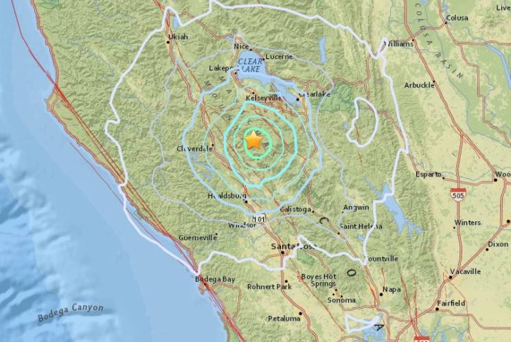
The Geysers in California, USA is the world’s largest geothermal field containing 18 power plants which draw steam from more than 350 wells. Earthquakes up to magnitude 5 are likely caused by the water injection. Gravity and GPS monitoring campaigns have revealed gravity decrease and subsidence in gross agreement with the known production and injection masses (Getting et al., 2011).
M5.0 induced earthquake near the Geysers geothermal field in Northern California, USA december 2014.
Subsidence as a geohazard
Large movements can cause huge problems such as sinking cities (Venice, e. g. Tosi et al., 2013) or regions (parts of the Netherlands). By combining the subsidence measurements with gravity changes, the root causes may be better understood.