Rock properties, such as porosity, fluids, pressures, and their dynamic (time-lapse) changes. Often reservoir flow models contains all required information.
Rock stiffness, uniaxial or triaxial, rock or pore compressibility
Quantification of model uncertainties or multiple subsurface models
Seafloor or surface topography. Geotechnical properties for the foundation of measurement platforms
Station layout, or multiple layouts
Cost of different components of data aquisition
Forward modelling from subsurface models
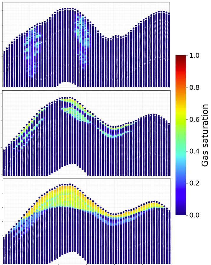
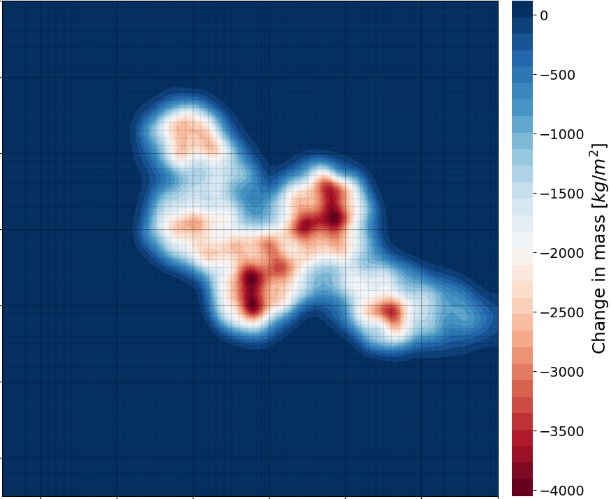
Calculate geometry of reservoir mass changes from the property model(s). Gravity forward modelling to the surface station grid(s) using Newtons law.
Calculate geometry of reservoir heights from the property model(s), usually pore pressure. Deformation forward modelling to the surface station grid(s) using the Geertsma approximation.
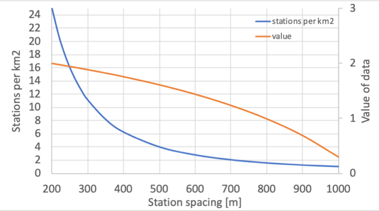
Station coverage density (blue line) and indicative value of data (orange line). The largest separation of the curves, at 500-600 m spacing, may give the highest net value. From Eiken and Zumberge (2019).
Simulating surveys
Select station grid(s), if not given initially
Add noise with realistic level and properties
Simulate noisy data with sequence of measurements, drift errors and other correlated noise components
Process the simulated data
Match with reservoir models or invert for reservoir properties
Estimate uncertainties based on mis-matches or inverted differences from initial model
Cost estimates for various station grids and survey layouts
Cost-benefit analysis
Cost estimates for various station grids and survey layouts