Onshore gravity surveys
We carry out gravity surveys in different terrain and climate. We select instrumentation to fit the purpose.
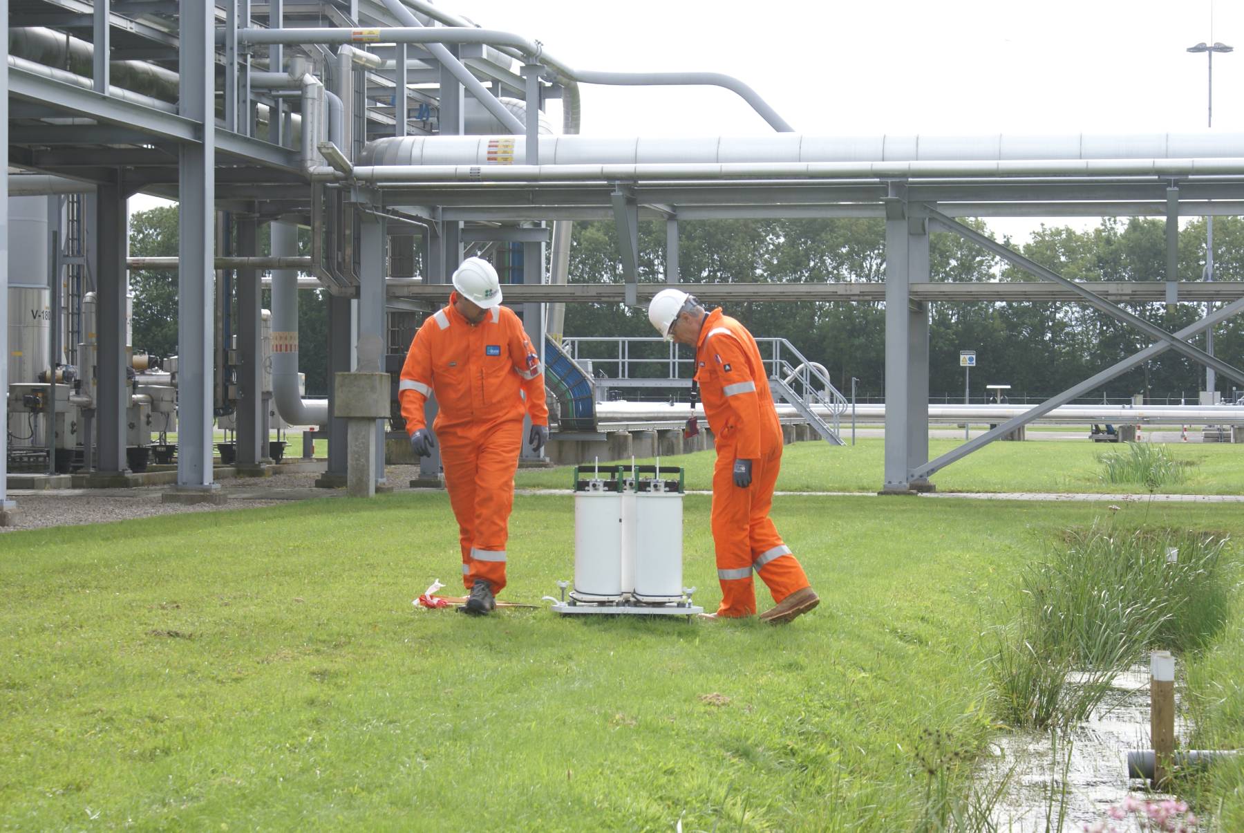
We use our proprietary ROVDOG instrumentation in light-weight cases. The instrument is run on batteries and connected to a laptop computer in a survey vehicle. This provides raw data in Quad-internal format which are further handled in the Attrack software.
Two or three shifts with two-person crews can operate 24/7. For stations with road access, set-up time is about 10 minutes. Survey progress is usually faster than 1 station per hour. Stations without road access may be reached by ATV or by foot – at a slower speed though.
In order to obtain 1-2 µGal time-lapse accuracy, height changes need to be determined within a few mm. Onshore, this will require a system better than GNSS, such as InSAR or optical levelling. Offshore, water pressure provides the required accuracy.
Gravity changes caused by ground water fluctuations should be corrected for – if hydrology is not the target for the gravity survey. Data on ground water may be gathered in shallow wells, with the help of a hydrological model or by other means.
We use CG-6 instruments as provided by Scintrex and GNSS positioning for precise mapping of an area. With such lightweight equipment one fit person can cover large areas of otherwise inaccessible mountain terrain. Where an ATV or a car can be used, survey progress will be even faster. The one-person crew we can often make 30 – 60 stations a day, dependent on the terrain and distances between stations.
Relative accuracy may be around 5-20 µGal, which usually is sufficient for mineral exploration or engineering applications. The accuracy will be better with some time invested in 1) improved drift control by more repeats and 2) longer recording time. To obtain accuracy below 5 µGal will only require a modest increase in survey time.
