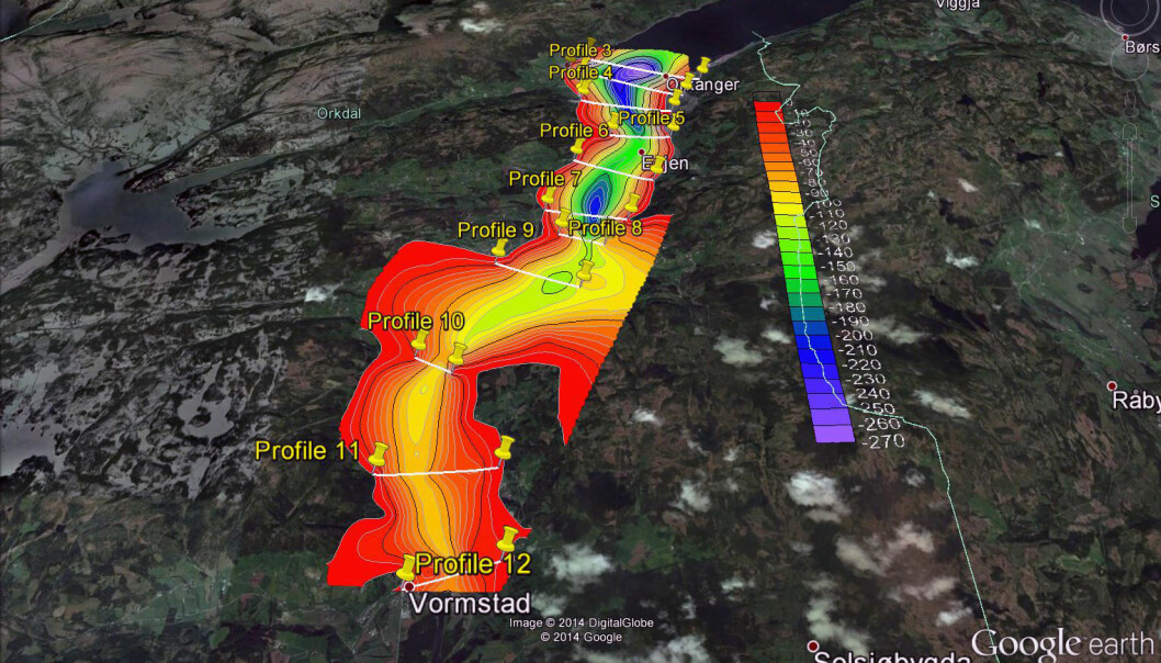
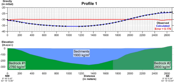
Modeled depth to bedrock. Bottom: Cross-section showing the depth to bedrock and densities. Top: Observed gravity in blue and residual after modeled gravity is subtracted in red. From Tassis et al., (2014).
Microgravity in Geohazard Detection and Engineering
Gravity can detect karst terrain for engineering applications. Castello et al. (2010) used microgravity to investigate subsurface cavity in urban Naples, Italy. Kobe et al. (2019) monitored leaching and transfer of soluble and dissolved rocks in the subsurface of Bad Frankenhausen, Germany by time-lapse microgravity. Tuckwell et al. (2008) discussed the use of microgravity to detect small voids and low-density ground for engineering purposes.
Variations in the depth to bedrock can be estimated from gravity when there is a significant density contrast with the overlying, usually unconsolidated sediments. In parts of the world with strong density contrasts such as Scandinavian post-glacial marine sediments this can be a cost-effective way of mapping prior to building of roads, develop urban areas, etc.