Microgravity & Height

for monitoring and mapping

Precise, reliable and cost-effective data onshore and offshore.

Technology

A illustration of gravity showing a globe, apple and computer with analysis.

20 november, 2023

While measurements with precision down to one μGal (one μGal is 10–8 ms–2) have been obtained at laboratory conditions for decades (e.g., Torge, 1989), recent advances have made it practically possible to carry out field surveys at such accuracy, and stationary measurement at sub-μGal precision. This increases the potential applications of gravity to smaller and deeper targets, with lower density contrasts and monitoring over shorter time-lapse intervals.

20 november, 2023

On land, subsidence or uplift can be measured with a few mm precision by InSAR, GPS or optical levelling. Deformations can also be accurately measured by tiltmeters or strain meters. Optical or electromagnetic signals hardly penetrate to the seafloor, and the tilt/strain methods require further R&D – both on land and at sea – to find practical and economical applications. At the seafloor, water pressure can be a precise proxy for depth.

Industry news

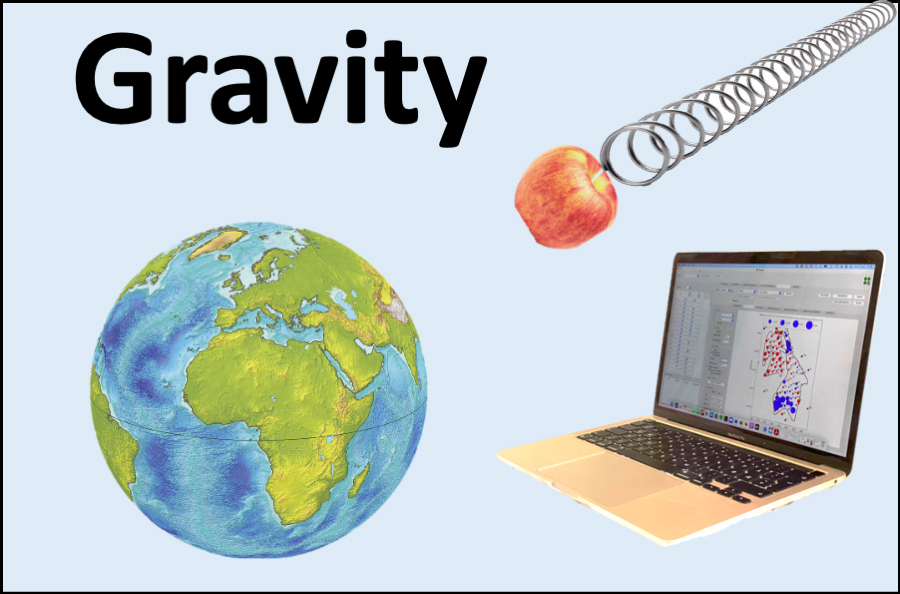
Gravity and subsidence monitoring at the seafloor should be feasible at the Endurance CO2 injection site

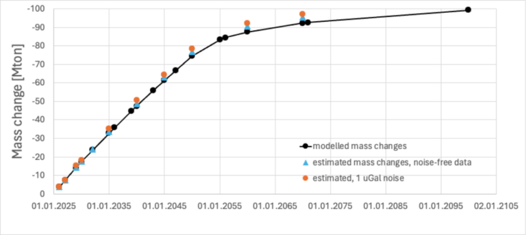
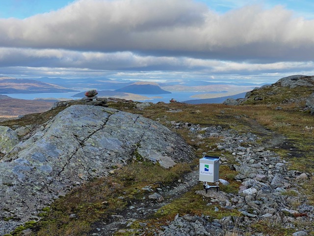
Quad Geometrics has together with bp completed a feasibility study for the Northern Endurance Partnership, which plans to inject 100 Mt of CO2 into Endurance over 25 years. Gravity reductions of up to 2.4 µGal/year are expected at the seafloor, caused by CO2 replacing formation water in the storage reservoir. Changes will accumulate to more than 100 µGal 75 years after injection starts. Monitoring these changes could serve as a control on the subsurface mass movements (Figure). Seafloor uplift is expected to be measurable. The rate of uplift will decrease with time, while the area of uplift will expand as a broader area becomes pressurized. Uplift data can give important information on the pressure development beyond the saturation front, which may be valuable for management of injection operations and for understanding storage capacity potential and regional pressure interference (e.g., with other CO2 stores). Accurate uplift measurements will require seafloor benchmarks which can withstand scour and moving sediment waves. Installed structures which are well founded and protected with, for example, gravel or concrete mattresses could provide stability. A grid with some tens of stations up to 25 km away from the injection wells would provide good resolution and coverage of the CO2 plume and pressurized water. Signal/noise ratios for gravity and depth changes will be sufficient for inversions and matching of flow models for timespans >2 years. Results should be interpreted together with injection data (masses, fluid composition, and pressures), and any monitor well and 4D seismic data. Once calibrated, gravity and deformation data may provide sufficient monitoring information to reduce the amount of seismic data necessary to monitor the CO2 plume with confidence. Gravity data may also be of particular value in the post-injection phase to confirm stable containment of the CO2 plume in the storage site when seismic may be less effective at imaging saturation changes within the plume footprint. Modelled reservoir mass changes (black dots) and inverted mass changes (blue and orange dots) based on measured seafloor gravity changes. Model assumes injection starts on 1st Jan 2025.

Gravity surveying at Skorovas Gruber

Quad Geometrics has carried out a gravity survey for Skorovas Gruber A/S (contact: Knut Berger, phone +47 941 46 010) in the autumn of 2024. This took place in the mountains of Trøndelag county, Norway, at the Skorovas mine. Nearly 6 million tons of sulphide ore were extracted, and copper, zinc and sulphur were exported before the mine was closed in 1984. The 2024 survey explored a larger area with high-precision microgravity technology for the first time. We used a CG-5 gravimeter and satellite positioning with CPOS correction giving cm-level accuracy. The terrain is best accessible by foot, and data acquisition was completed shortly before the winter arrived. We processed the gravity data with our internal software Attrack. This included terrain correction using a model with 1 m lateral resolution, which improves in an area with such rugged topography. Resulting maps were of high quality. The gravity data will form the basis for further exploration in the area. The search for minerals such as copper is picking up in Norway. High-resolution gravity imaging can be a powerful tool, as has been experiences elsewhere.

Innovative technology in gravity & seafloor height measurements

About Quad Geometrics

We are a small and dedicated team specialising in the technology of high-precision gravity and height measurements for a wide range of subsurface applications. From our base in Trondheim, Norway we provide services around the world. This can be either field measurements, data analysis or full project responsibility.

Contact us for onshore & offshore solutions

Get in touch with us